
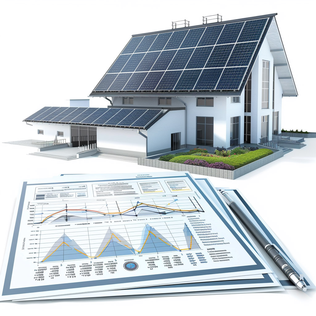
Parcel analysis, building regulations, and instant CAD exports
all in one place.
Switzerland's comprehensive platform for architects that centralizes cadastral data, building codes, and 3D terrain models. Terrara brings together all Swiss parcel information and environmental assessments in one platform, with instant DWG/DXF/IFC exports ready for your architectural workflow.
Everything architects need for efficient project planning:
- Municipality Building Codes
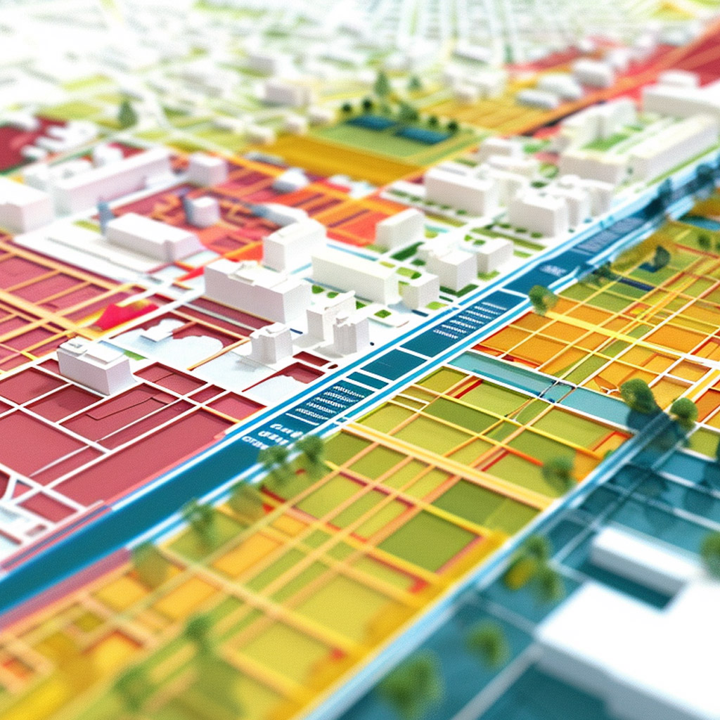
- Property Zoning Type
- Construction Potential
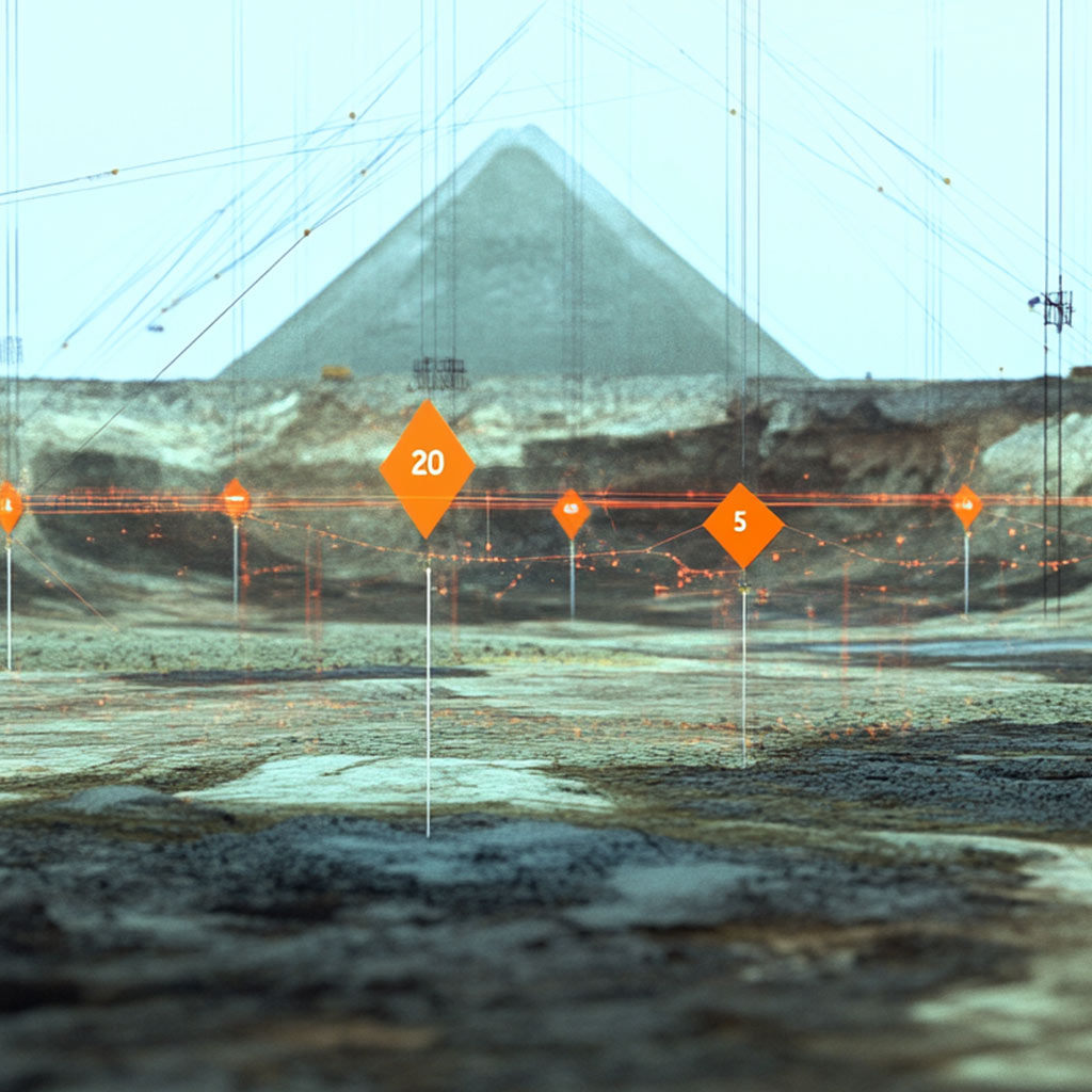
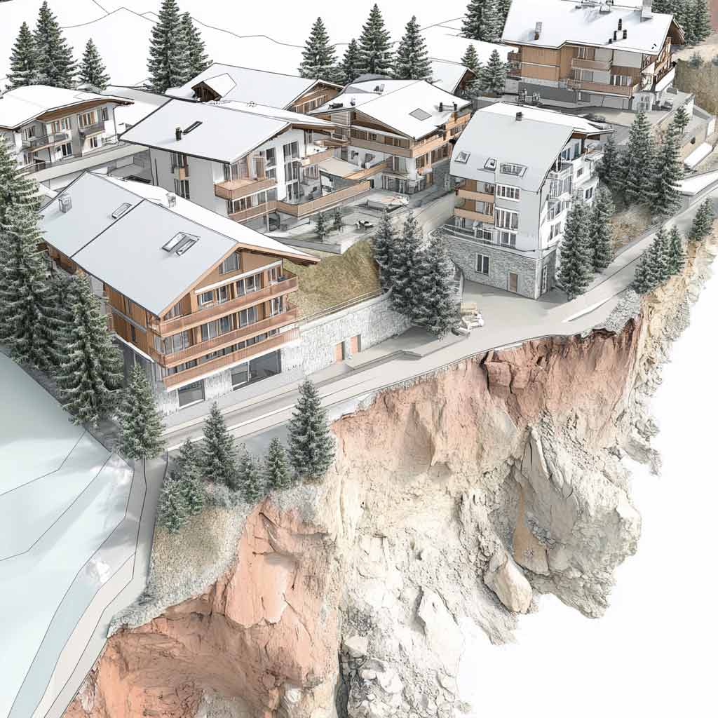
- Building Volume Analysis
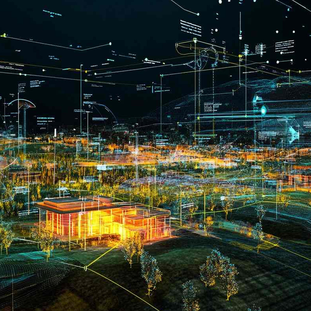
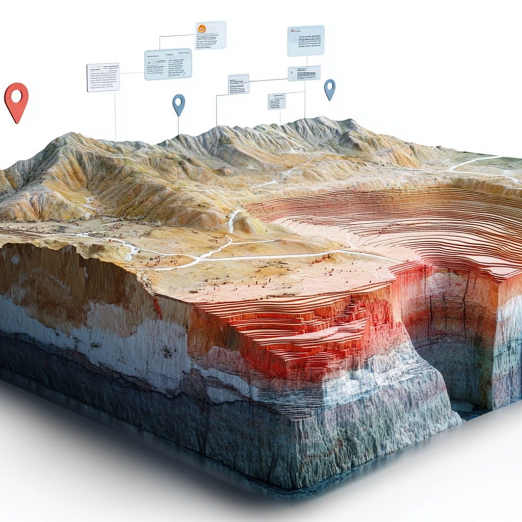
- Visual Terrain Mapping
- Local Fixed Points
- Hazard Assessment Layers
- AI-Powered Value Estimation
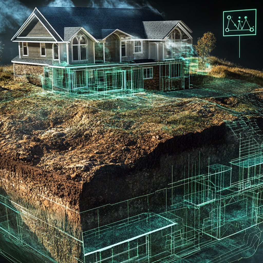
- 2D and 3D Terrain Model Export (DWG/DXF/IFC)
- Protected Heritage Site Boundaries
- Noise Exposure Mapping
See the Difference Yourself
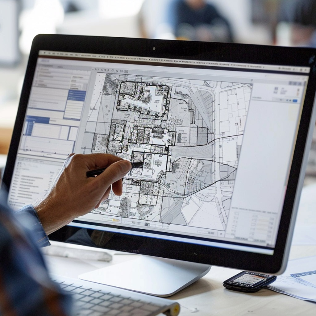
Search for a parcel – all data in seconds, not hours
Ready for Your CAD Workflow?
You've found all the data in seconds. Now export it directly to your CAD program.
Your Advantage: 100 free analyses • No credit card required
How Terrara Transforms the Architectural Workflow
Traditional Process
Terrara Process
Traditional Process
Terrara Process
Terrara's streamlined workflow dramatically reduces research time for architects, allowing you to focus on design rather than administrative tasks.
Ready to Transform Your Architectural Workflow?
Join hundreds of Swiss architects who have reduced their research time by up to 90% and improved their project efficiency.
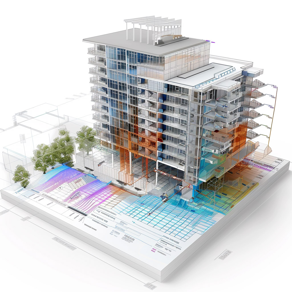
Unparalleled Property Intelligence for Architects
Terrara is a comprehensive building plot analysis platform that provides detailed insights across 142 parameters, building codes, and visual mapping layers for architects, developers, and land planners seeking to streamline their project workflows. Available in Switzerland's three national languages (German, French, and Italian) plus English, Terrara ensures all cadastral data, technical parameters, and regulatory information is fully translated in each language, allowing seamless access to critical property information regardless of linguistic region.

142+ Parameters for Complete Architectural Insights
Every critical data point for confident design decisions.


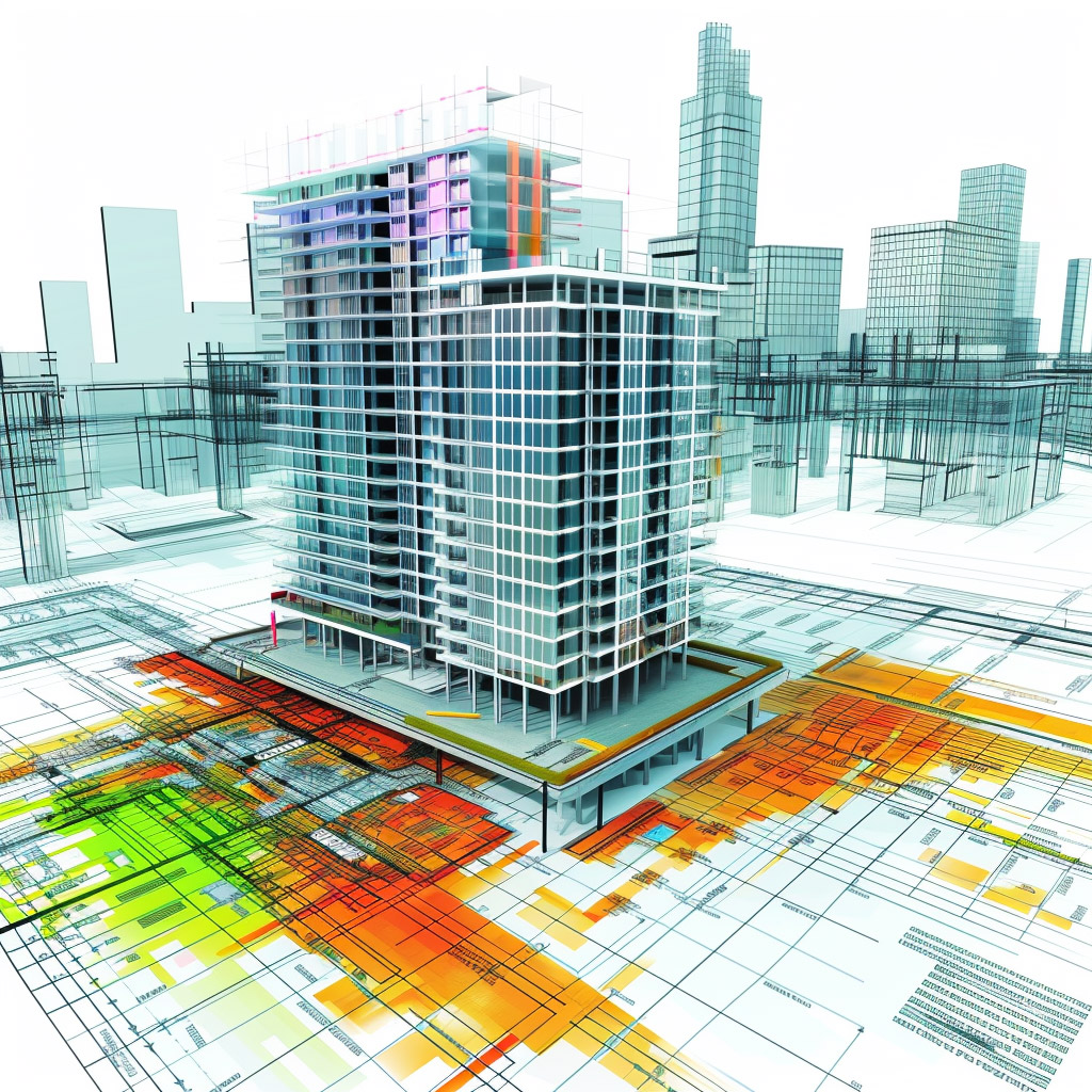
See What Other Architects Miss
Visualize properties across 11+ specialized mapping layers for better design decisions.


Available in Switzerland's three national languages (German, French, and Italian) plus English
Terrara ensures all cadastral data, technical parameters, and regulatory information is fully translated.
Simple Pricing for Architects
Choose the plan that fits your workload
Free
Test Terrara with 100 complete property analyses
- 100 property analyses free
- Full cadastral data view
- View building regulations
- No credit card required
Basic Plan
Perfect for individual architects with 1-2 projects per month
- 150 Advanced Searches
- 150 Full Views
- 20 Report Downloads
- 30-day free trial
Standard Plan
Ideal for small architecture firms with regular projects
- 350 Advanced Searches
- 350 Full Views
- 50 Report Downloads
- 30-day free trial
Premium Plan
For architecture firms handling multiple projects simultaneously
- 750 Advanced Searches
- 750 Full Views
- 100 Report Downloads
- AI Building Analyzer
- 30-day free trial
Architecture Data Services
We create custom data files (DXF, DWG, IFC, etc.) for larger areas, municipalities, cities, or cantons. Custom quote on request.
Request QuoteNo Risk
Test all features risk-free. No credit card required.
No commitment. Cancel anytime through your account settings.
Upgrade or downgrade anytime as needed.
AI Building Code Analysis & Development Potential
Terrara's AI Building Analyzer revolutionizes property development by intelligently cross-referencing parcel-specific data against municipal and cantonal building codes to generate tailored compliance reports. The system instantly calculates maximum buildable potential, identifies restrictions, and suggests optimal construction configurations that maximize developable space while maintaining regulatory compliance. Our AI continuously monitors regulatory changes across Switzerland, ensuring analyses always reflect current requirements. The intelligent recommendations engine evaluates construction scenarios, helping developers avoid costly compliance issues while identifying unique optimization opportunities that might otherwise be missed during manual review processes. This powerful feature transforms complex regulatory landscapes into clear, actionable development strategies for each unique parcel.


Frequently Asked Questions
Find answers to the most common questions about Terrara's property intelligence platform.
Terrara provides comprehensive property data across 142+ parameters including cadastral information, zoning regulations, building codes, construction potential, environmental assessments, natural hazards, heritage status, and more. Our platform offers complete insights for developers, investors, and land planners in Switzerland.
Terrara is available in Switzerland's three national languages (German, French, and Italian) plus English. All cadastral data, technical parameters, and regulatory information is fully translated in each language, allowing seamless access to critical property information regardless of linguistic region.
Terrara's AI Building Analyzer is regularly updated with the latest municipal and cantonal building codes across Switzerland. Our system continuously monitors regulatory changes, ensuring analyses always reflect current requirements. The platform has been tested against manual expert reviews with a compliance accuracy rate of over 95% for standard property types.
Terrara sources data from official Swiss topo official registers and processes these files ourselves to ensure accuracy and consistency. This official data forms the foundation of our 142+ parameter analysis system, providing you with reliable and authoritative property information.
Yes, Terrara offers instantly downloadable DXF, DWG, and IFC files containing precise parcel boundaries and 3D terrain models. These architectural-ready files enable architects to begin projects immediately with accurate site conditions and topography. For larger areas, we also offer custom data services for municipalities, cities, or entire cantons.
Yes, we provide bulk files service for larger area coverage. This service is ideal for professionals working on multiple properties, entire neighborhoods, municipalities, or cantons. Our custom data packages can be tailored to your specific project requirements and delivered in your preferred format.
You can cancel your subscription at any time through your account settings. Log in to your Terrara account, navigate to the Subscription section, and click on "Cancel Subscription." Your access will continue until the end of your current billing period. If you have any issues, our customer support team is available to assist you.